


After Stephenson’s 1957 report, the city of Halifax had defined a central redevelopment area. Between 1958 and 1962, the city focused on acquiring and clearing the land, clearing 17.3 acres by 1962. With the land acquired and cleared, it was now time to focus on what to do with it.
The city’s director of planning, K.M Munnich, recommended in a preliminary report that a development including high density residential, shopping centre with large department store, and ample parking would be ideal for the site. By 1964, this report had expanded to a draft plan for the area, and included expansion of the area to include lands between Brunswick Street and Grand Parade; Cogswell Street and Rainnie Drive; and the entire frontage of Duke Street. To further guide development, the firm Canadian Urban Economics Ltd was commissioned to do two studies.
The first, the 1965 Central Business District Report, looked at expected growth between 1966 and 1986. It recommended more low and mid-cost housing in the area, and also recommended against expansive retail development, accepting that it had been lost to suburban malls. The preference was to concentrate on office space. The report also called for commercial recreational facilities such as theatres, curling and billiards, and an institutional component of museums, art galleries, a courthouse and a maritime museum, and of course sufficient parking.
In 1966 Canadian Urban Economics Ltd produced their second report, “Central Business District Economic Analysis for Redevelopment Planning”. This report suggested making the waterfront a priority for a new courthouse and the redevelopment of the ferry terminal; developing the Grand Parade from Duke Street to George Street; removing the existing City Hall to make way for a proposed department store; extending the Grand Parade toward the north to Duke Street; making Barrington Street a pedestrian maIl from Duke Street to Sackville Street; redesigning the traffic circulation; and moving parking to each end of Barrington Street.

While ever-expanding grand plans for downtown were being made, in January 1962 the city issued a request for proposals for the cleared lands. There was one submission, for the Cornwallis Centre, by Provinces and Central Properties Ltd, developed by the British Woking Group, from Surrey, England, working locally with Napier and Napier Architects .

The programme consisted of apartment blocks, which were the first priority, followed by the rotunda and hotel block, office block, market hall, the department store and finally the sports dome. The towers would sit atop a pedestrian podium. The Cornwallis Centre was to be built at grade, with the lower levels housing parking and bus bays. Escalators would bring people into the pedestrian podium.
The proposal included the Cogswell Street Extension, which would bring people into the heart of the centre, via public transit. Market Street would remain as a service road, but all other streets within the site would be removed. The towers were aligned to preserve views from Citadel Hill. 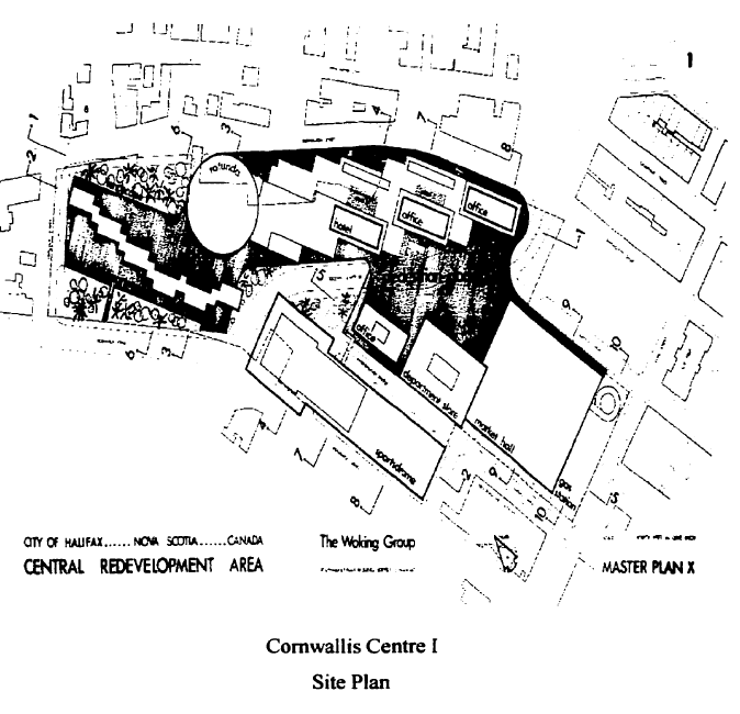
The total estimated cost for the proposal was $48,700,000. It was immediately criticized for being too large and out of character for Halifax. Mayor Vaughan was first elected in the 1963 election, campaigning against the Cornwallis Centre (he was the manager of Halifax Shopping Centre at the time).
The Woking Group was asked to come back with something different.
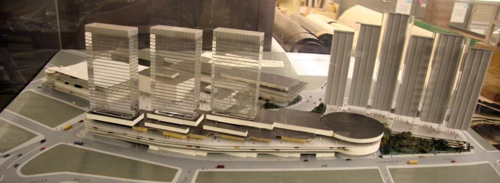
Version 2 of the Cornwallis Centre was radically different. Still a multi-use centre, the plan called for 450 dwelling units; a 450-room hotel; a 22 floor office tower offering 264,000 sq ft of office space; 554,000 sq ft of shopping, including two department stores, a grocery store and a car showroom; and parking for 2500 cars, with space for 600 more in the future. Pedestrians were still kept in a separate landscaped plane from cars, and the only surface entrances were at the hotel.
The centre was viewed as the first phase of a comprehensive planning area, so additional improvements in the area of the courthouse and ferry terminal are included. Cogswell Street was also treated differently, passing over Harbour Drive.
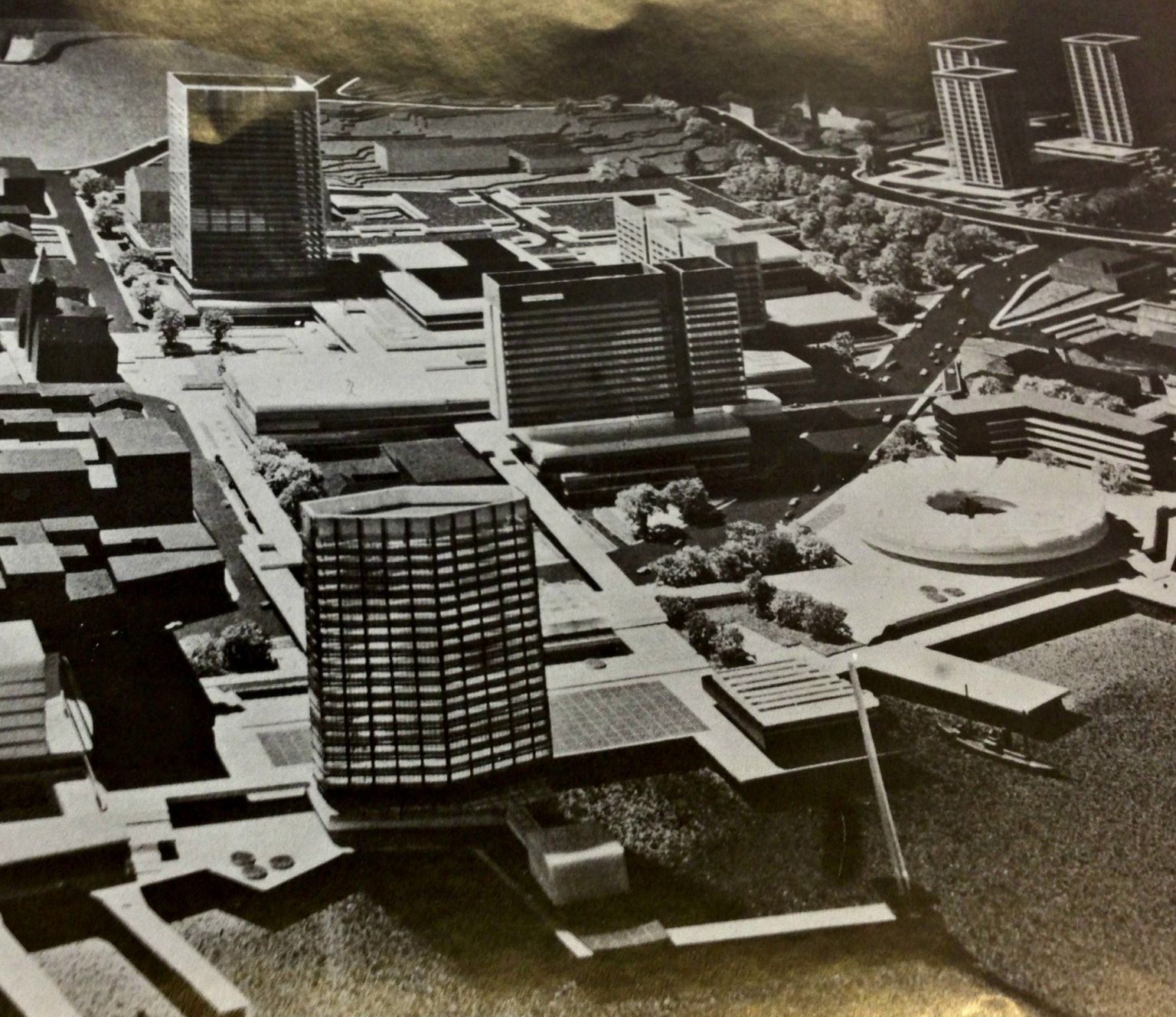
The residential component featured 420 units in three 18 story highrise towers, and 30 in patio terraces that made up a podium for the 3 towers. Parking and services were also held in the podium.
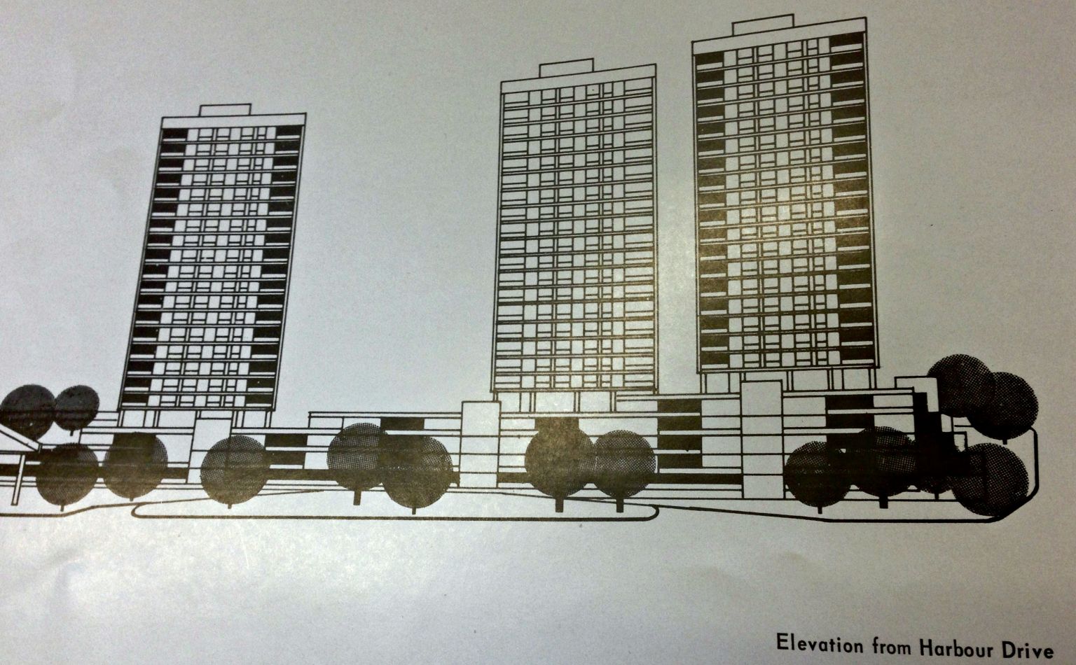
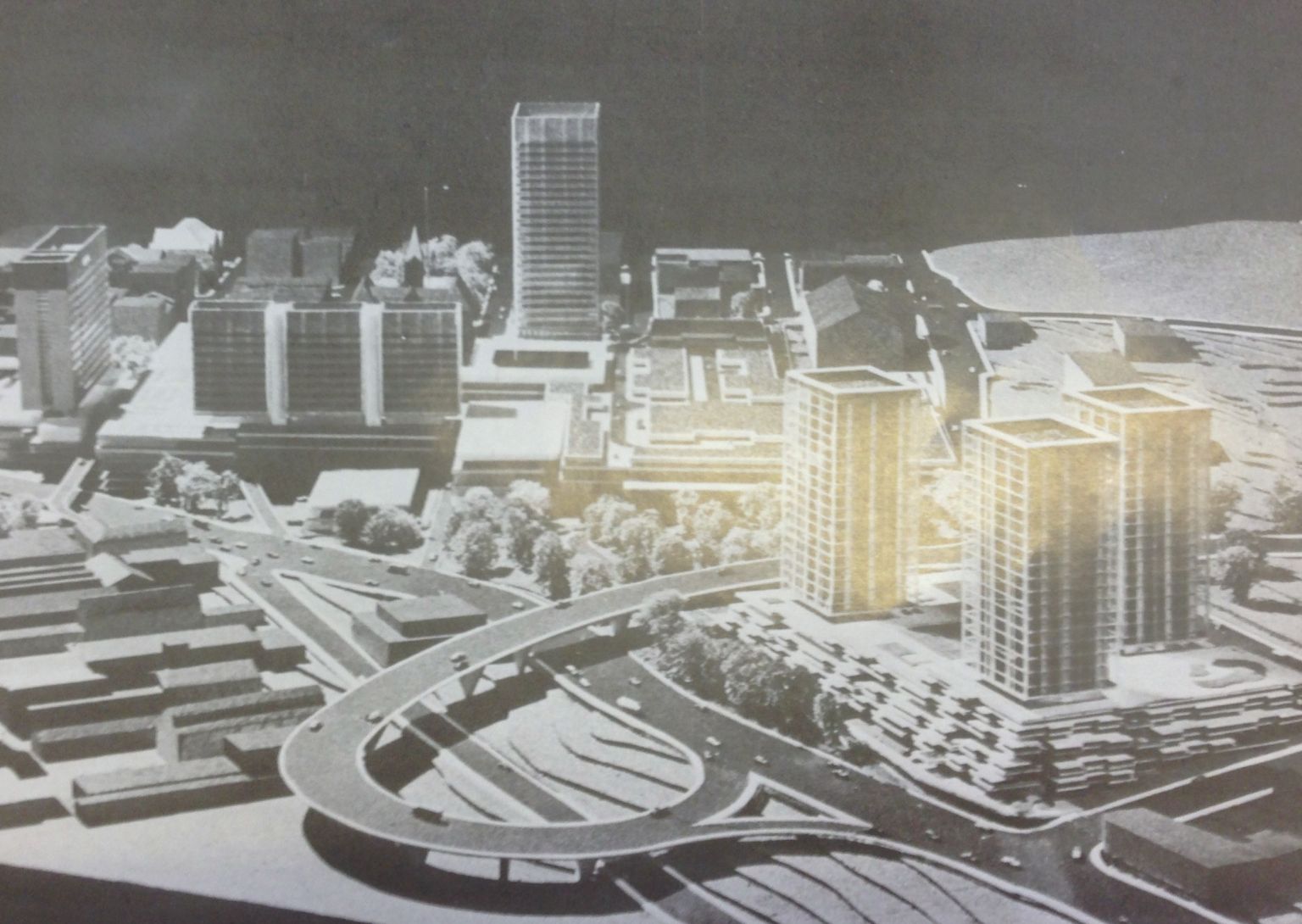
Apartment towers viewed from Harbour Drive. Page is bent, hence distortion.
The office tower was designed to be just under 300′ in height. It was decided that a single tower of 20 to 24 stories would give more punctuation and drama to the skyline, without impacting the view from the Citadel. Provision for an additional 100,000 sq ft of office space was made via 3 shorter linked towers that could be built later.
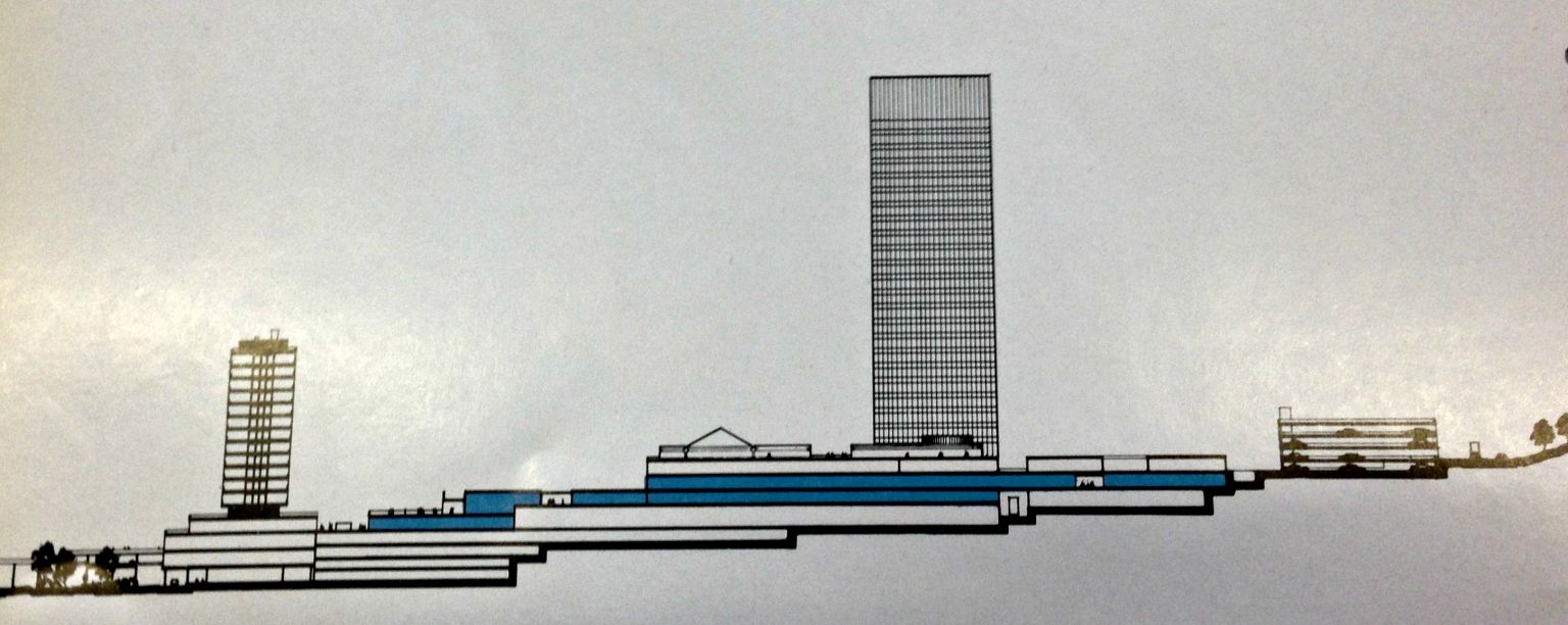
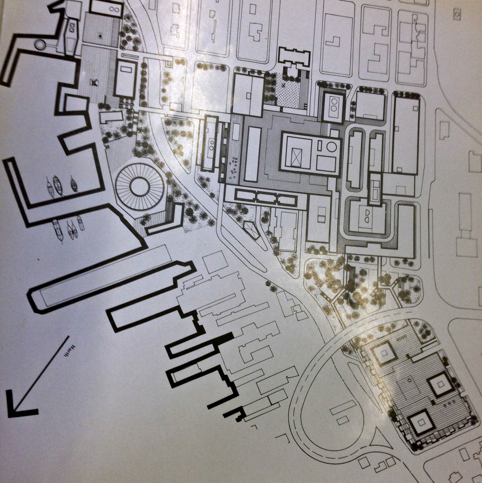
Cross Section. Office Tower on Right, Hotel on Left.
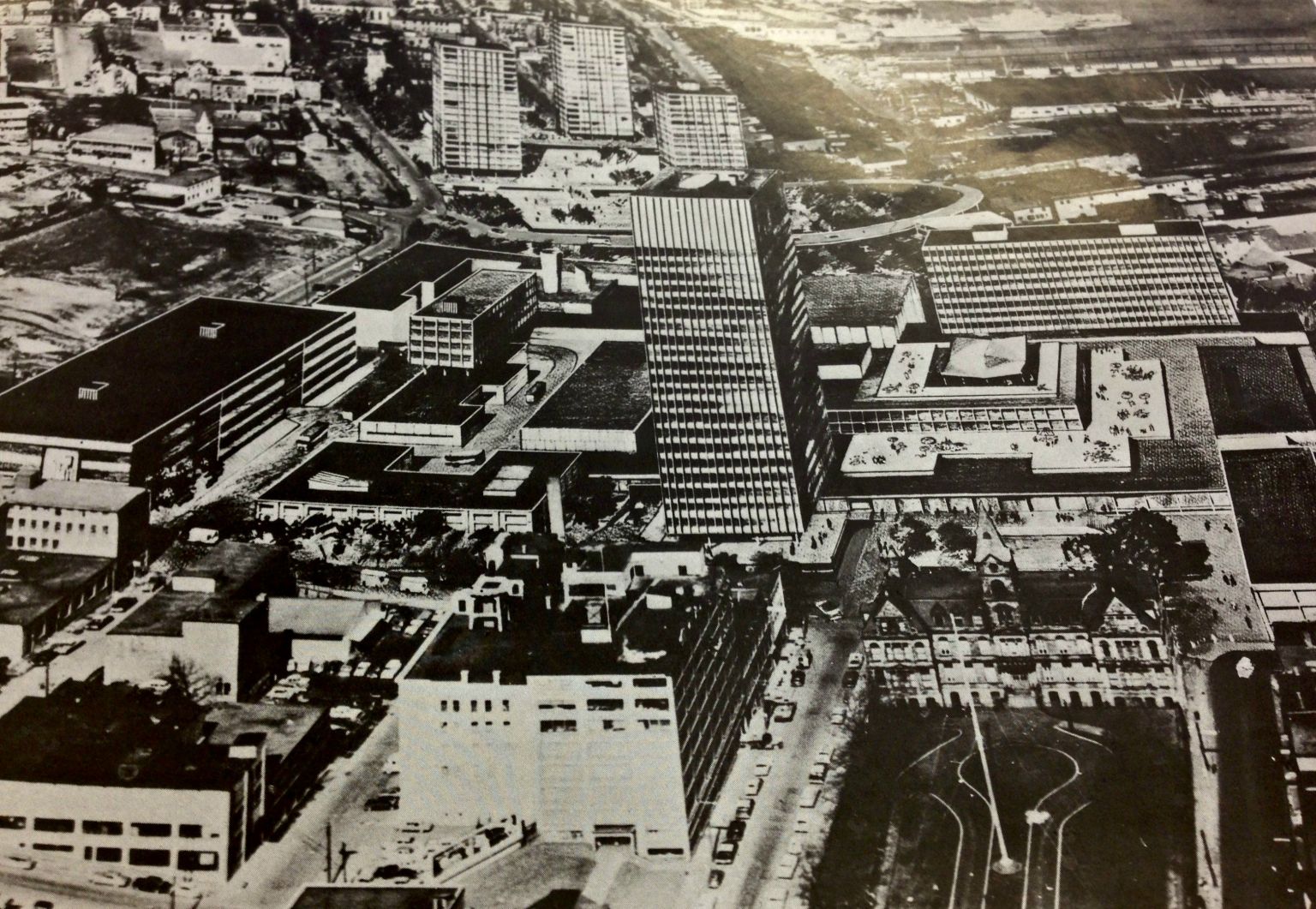
Overall view looking North. Office tower and additional office space centred. Note City Hall in lower right corner.
This proposal was ultimately accepted, and the city signed an agreement to proceed in October 1963.
