


Gordon Stephenson was brought in by Halifax Council in 1957 to develop a plan for slum clearance. Stephenson was considered to be an expert in urban renewal and, as advocated by modernists like Corbusier, used scientific rigor to justify his findings.
Stephenson was well educated, having studied at the School of Architecture, University of Liverpool, between 1925-1930 and the Institut d’Urbanisme, University of Paris, between 1930-1932. His time in Paris would have been after Corbusier published “Vers une architecture” (Toward an Architecture, previously mistranslated into English as Towards a New Architecture) in 1923, so he would have been familiar with the work and the ideas it contained. Some sources suggest he worked in Corbusier’s practice.
Prior to his time in Canada, Stephenson also worked in Australia. In the Australian experience, Walter Burley Griffin laid out the capital city of Canberra based on Garden City principles in 1912. Stephenson would have been very familiar then with Garden City , and modern ideas in town planning.
During his time in Canada, Stephenson served as a planning consultant to the cities of Toronto, Kingston, Sudbury and Ottawa, Ontario, as well as Halifax, and taught at the Universities of Toronto and British Columbia, between 1955-1960.
It is with this resume, that he was selected by the city of Halifax and CHMC to undertake the redevelopment study for Halifax. In his report on Halifax, he made extensive use of studies and surveys to document the conditions of the city and justify its redevelopment. Stephenson’s report begins with a historical review of the city, and a collection of photographs showing the picturesque areas of the city, and finally ends with blighted neighborhoods.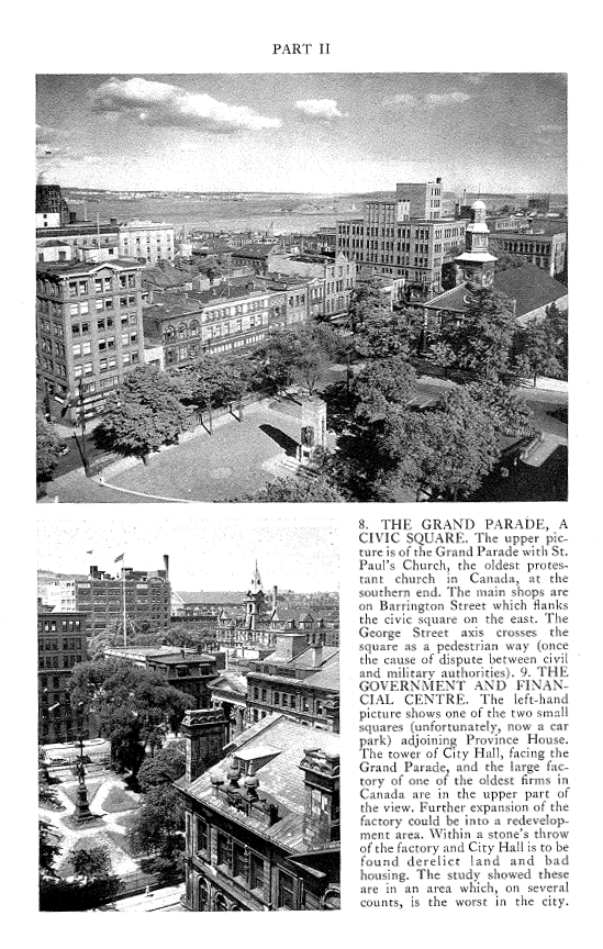
In Section III, Stephenson begins to describe the problems and proposals for Halifax. He determines that the majority of growth will be suburban, however this will leave the core to remain run-down and blighted. “Here many of the worst dwellings are to be found, and with them social and economic difficulties.”
Perhaps ironically, Stephenson points out what uncontrolled suburban growth will cause:
“…the money to put them right will mount inexorably. It is estimated that it will cost $5000-6000 per house in some places to provide water and sewers to cheap houses which are now laid out in sprawling fashion on rocky land. It was cheap land – but it will be very costly land by the time the community as a whole has paid the price.”
“Clearance and re-development in the city will undoubtedly increase efficiency in the hub of the metropolitan region, and remove some of the slums in the worst parts.”
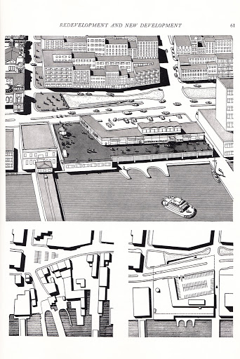
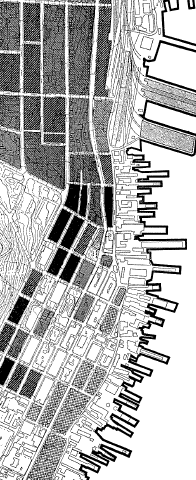
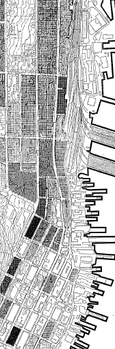
On the harbour and central area, Stephenson suggests re-developing the ferry terminal area, to bring the harbour into the urban scene, and to provide parking for 300 cars (below).
 Each dot represents a person on Welfare |
 Each dot represents 100 people |
 Each dot represents a child with tuberculosis |
 Each dot represents the home of a child appearing in Juvenile court. |
Stephenson basically shows by dot density how bad the study area is compared to the rest of the city. The more dots, the worse the conditions are. In Part 5, he then goes on to look at the specific structures in the area. Part 5 was completed by a block-by-block survey which was conducted as part of the study.
 The dark areas: 75% or more of buildings are in poor condition with 2 or more major issues |
 Houses with more people then rooms are considered overcrowded. The darkest square: 75% or more are over crowded |
 In the black squares, 30% or more of dwellings lack indoor washrooms |
In parts 4 and 5, Stephenson is able to use scientific factual study to justify the redevelopment of large areas of Halifax based on the human and built conditions of the areas. He then goes on to define several redevelopment areas that should be cleared.
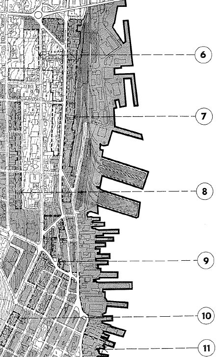
Area 6 is what would become Uniacke Square, Area 7 would be cleared and largely remain so to this day, and Area 9 would be Cogswell and Scotia Square. For Area 6, a new library and playground are recommended. On Area 9, Stephenson writes “There are three proposals for the City Center. The first involves sweeping away the worst housing in the City, which is in the vicinity of Jacob and Market Streets. This would provide excellently placed commercial sites, and a much needed road improvement by connecting Cogswell Street to Water Street on a new alignment.”
Given that he suggests most of the central area be redeveloped commercially, he acknowledges that additional housing must be located for the displaced people.
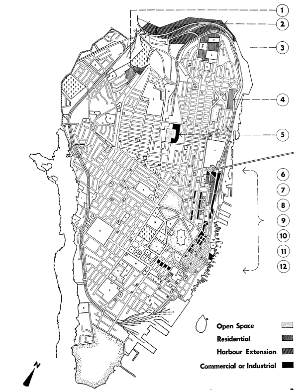
The overall scheme is quite comprehensive. The central study areas are recommended to be converted primarily to commercial and industrial uses. Africville is flagged for harbour expansion (2). Bayers-Westwood(1), Rockhead Prison (3) and Mulgrave Park (4) are suggested as a site for new housing, as is the area that would become Uniacke Square, and the Ocean Towers. The report recommends re-housing Africville residents at the Rockhead site.
The Halifax City Archives has the report available online in PDF.
The report was presented to Council, Approved, and Expropriations and Demolitions in the Jacob Street Area (Which would become known as the Central Redevelopment Area) Began in February 1958.
